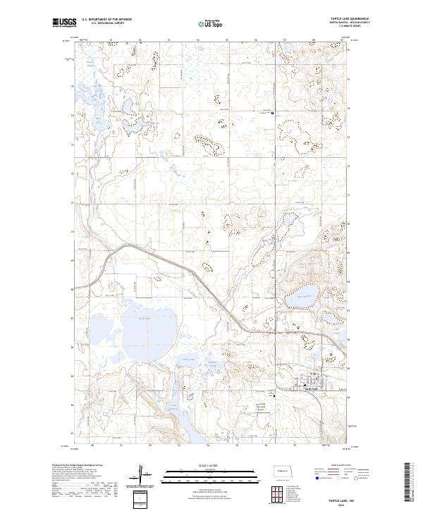
2024 Map of Turtle Lake
USGS Topo · Published 2024About this map
Turtle Lake serves as the focal point of this prairie landscape, where the town of the same name sits at the intersection of a significant regional road and water network. The surrounding terrain is defined by a series of kettle lakes and sloughs, including Lake Brekken, Lake Holmes, and the marshes of the Lake Nettie National Wildlife Refuge. This concentration of water bodies is further managed through the McLean County Waterfowl Production Area, reflecting the area's importance for migratory bird habitat and conservation. Local history is anchored by the Saint-Olaf Lutheran Cem and Turtle Lake Cem, while modern infrastructure is represented by the Turtle Lake Municipal Airport and the North Country National Scenic Tr which winds through the eastern hills. The map captures a well-preserved grid of township roads and section lines typical of the Dakotas.
Find a feature on this map
36 named features on this map. Tap any name to fly to it.
Don’t see what you’re looking for? This feature index may not catch every label — zoom into the map to look around manually.
Map Details
Editions of this 2024 Turtle Lake Map
This is the sole edition of this map. No revisions or reprints were ever made.
Other maps of this area

1929 · Coleharbor
USGS Topo · 1:62,500

1947 · Turtle Lake
USGS Topo · 1:62,500

1949 · Turtle Creek
USGS Topo · 1:62,500

1949 · Washburn
USGS Topo · 1:62,500

1954 · McClusky
USGS Topo · 1:250,000

1958 · McClusky
USGS Topo · 1:250,000

1961 · Turtle Lake
USGS Topo · 1:24,000

1961 · Lake Nettie
USGS Topo · 1:24,000

1961 · Turtle Creek NE
USGS Topo · 1:24,000

1961 · Washburn NE
USGS Topo · 1:24,000