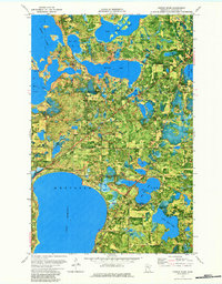
1972 Map of Turtle River
USGS Topo · Published 1984About this map
Lake Bemidji and the upper reaches of the Turtle River watershed dominate this northern Minnesota landscape in the early 1970s. The map captures a transition between the recreation-focused shores of Lake Bemidji State Park and the working forest lands of the Buena Vista State Forest. Smaller settlements like Birchmont and Lavinia are anchored by the lakefront, while the interior is dotted with numerous glacial lakes, including Beltrami Lake, Three Island Lake, and Big Bass Lake.
Find a feature on this map
33 named features on this map. Tap any name to fly to it.
Don’t see what you’re looking for? This feature index may not catch every label — zoom into the map to look around manually.
Map Details
Editions of this 1972 Turtle River Map
3 editions found
Other maps of this area

1920 · Buena Vista
USGS Topo · 1:62,500

1954 · Bemidji
USGS Topo · 1:250,000

1957 · Bemidji
USGS Topo · 1:250,000

1958 · Bemidji
USGS Topo · 1:250,000

1968 · Bemidji East
USGS Topo · 1:24,000

1968 · Bemidji West
USGS Topo · 1:24,000

1972 · Peterson Lake
USGS Topo · 1:24,000

1972 · Turtle River Lake
USGS Topo · 1:24,000

1972 · White Fish Lake
USGS Topo · 1:24,000
1972 · Turtle River
USGS Topo · 1:24,000