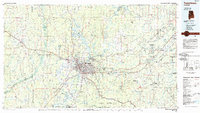
1984 Map of Tuscaloosa
USGS Topo · Published 1985About this map
The Black Warrior River serves as the industrial and recreational spine of this west-central Alabama region, flowing through a landscape defined by significant water management and university growth in the mid-1980s. The city of Tuscaloosa and the University of Alabama campus anchor the central portion of the map, while the surrounding countryside is dotted with small rural communities like Samantha, Echola, and Windham Springs. The transition from the urban center to the timberlands and coal-bearing regions is visible through the expansive reach of the Talladega National Forest and the Oakmulgee Wildlife Management Area. Transport infrastructure is heavily emphasized, with the Illinois Central Gulf and Southern railroads tracing paths through the hilly terrain. This period represents a time when the region's coal mining heritage was still highly visible in places like Black Diamond and Kellerman, even as recreational sites like Lake Lurleen State Park and Tannehill State Park became prominent local fixtures.
Find a feature on this map
100 named features on this map. Tap any name to fly to it.
Don’t see what you’re looking for? This feature index may not catch every label — zoom into the map to look around manually.
Map Details
Editions of this 1984 Tuscaloosa Map
2 editions found
Other maps of this area

1889 · Birmingham
USGS Topo · 1:125,000

1890 · Bessemer
USGS Topo · 1:125,000

1891 · Clanton
USGS Topo · 1:125,000

1892 · Birmingham
USGS Topo · 1:125,000

1892 · Bessemer
USGS Topo · 1:125,000

1893 · Jasper
USGS Topo · 1:125,000

1895 · Birmingham
USGS Topo · 1:125,000

1899 · Brookwood
USGS Topo · 1:125,000

1904 · Birmingham Coal District
USGS Topo · 1:62,500

1905 · Bessemer Iron District
USGS Topo · 1:62,500