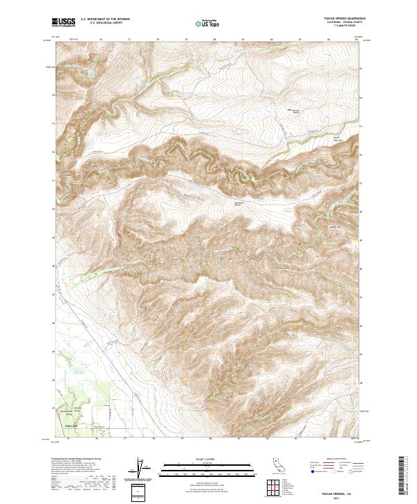
2021 Map of Tuscan Springs
USGS Topo · Published 2021About this map
Dairyville serves as the primary hub of activity in the southwestern corner of this landscape, where the flatlands of the Central Sacramento Valley meet the rising volcanic foothills. The terrain is defined by a series of dramatic volcanic ridges and plateaus, most notably The Hogback and the elevated reaches of Mud Springs Plains and Abraham Plains. Water is a persistent theme in this environment, from the thermal origins of Tuscan Springs to the seasonal drainage through Dehaven Gulch and Long Gulch.
Find a feature on this map
39 named features on this map. Tap any name to fly to it.
Don’t see what you’re looking for? This feature index may not catch every label — zoom into the map to look around manually.
Map Details
Editions of this 2021 Tuscan Springs Map
This is the sole edition of this map. No revisions or reprints were ever made.
Other maps of this area

1886 · Lassen Peak
USGS Topo · 1:250,000

1890 · Red Bluff
USGS Topo · 1:250,000

1892 · Lassen Peak
USGS Topo · 1:250,000

1894 · Lassen Peak
USGS Topo · 1:250,000

1894 · Red Bluff
USGS Topo · 1:250,000

1905 · Tehama
USGS Topo · 1:62,500

1935 · Paynes Creek
USGS Topo · 1:96,000

1941 · Mineral
USGS Topo · 1:125,000

1944 · Tuscan Buttes
USGS Topo · 1:62,500

1947 · Tuscan Buttes
USGS Topo · 1:62,500