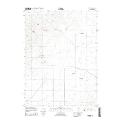
2014 Map of Tuscarora
USGS Topo · Published 2014About this map
Tuscarora sits at the foot of the Tuscarora Mountains in Elko County, where the high desert terrain transitions into the broad expanse of Independence Valley. This 2014 survey captures a landscape defined by its complex drainage systems, with numerous creeks such as McCann Cr, Pleasant Valley Cr, and Indian Cr flowing toward the S Fork Owyhee River. The map highlights the intersection of local history and geology, showing the village layout including Weed St and the regional connections via State Hwy 789 and Tuscarora Rd. To the northwest, the elevation climbs sharply toward peaks like Mt Blitzen, while the lower elevations are marked by the winding paths of Taylors Cañon Cr and Burns Cr. The grid-like survey lines of t40n r51e and surrounding townships overlay a territory shaped by ranching and mining heritage, providing a clear record of the area's rural road network.
Find a feature on this map
24 named features on this map. Tap any name to fly to it.
Don’t see what you’re looking for? This feature index may not catch every label — zoom into the map to look around manually.
Map Details
Editions of this 2014 Tuscarora Map
This is the sole edition of this map. No revisions or reprints were ever made.
Other maps of this area

1955 · McDermitt
USGS Topo · 1:250,000

1956 · Tuscarora
USGS Topo · 1:62,500

1956 · Mt. Blitzen
USGS Topo · 1:62,500

1959 · McDermitt
USGS Topo · 1:250,000

1970 · Sugarloaf Butte
USGS Topo · 1:24,000

1970 · Lake Mountain
USGS Topo · 1:24,000

1970 · Stampede Ranch
USGS Topo · 1:24,000
1972 · Lake Mountain
USGS Topo · 1:24,000

1982 · Tuscarora
USGS Topo · 1:100,000
1987 · Cottonwood Peak
USGS Topo · 1:24,000