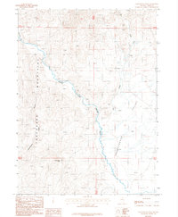
1987 Map of Cottonwood Peak
USGS Topo · Published 1987About this map
The South Fork Owyhee River snakes through a high-elevation basin in this 1980s landscape, serving as a primary drainage between the Tuscarora Mountains to the west and Independence Valley to the east. This section of Elko County is defined by its water sources and mining history, notably featuring the Spain site and a Prospect located in the western uplands. The terrain is dominated by Cottonwood Peak, which overlooks several significant tributaries including Cottonwood Creek and Hot Creek. Geologic activity is indicated by several Springs (Hot) found in the northern reaches of the valley. The map details a remote ranching and mining environment where high-altitude features like Swimmers Flat provide a glimpse into the late-20th-century character of northeastern Nevada's mountainous interior.
Find a feature on this map
14 named features on this map. Tap any name to fly to it.
Don’t see what you’re looking for? This feature index may not catch every label — zoom into the map to look around manually.
Map Details
Editions of this 1987 Cottonwood Peak Map
This is the sole edition of this map. No revisions or reprints were ever made.
Other maps of this area

1955 · McDermitt
USGS Topo · 1:250,000

1956 · Tuscarora
USGS Topo · 1:62,500

1956 · Mt. Blitzen
USGS Topo · 1:62,500

1956 · Bull Run
USGS Topo · 1:62,500

1959 · McDermitt
USGS Topo · 1:250,000

1964 · Wilson Reservoir
USGS Topo · 1:62,500

1982 · Bull Run Mts
USGS Topo · 1:100,000

1982 · Tuscarora
USGS Topo · 1:100,000
1987 · Big Cottonwood Canyon
USGS Topo · 1:24,000
1987 · Deep Creek
USGS Topo · 1:24,000