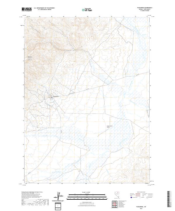
2021 Map of Tuscarora
USGS Topo · Published 2021About this map
Tuscarora stands as the primary settlement in this high-desert landscape of northeastern Nevada, situated at the base of the Tuscarora Mountains. The terrain is defined by dramatic elevation changes, notably at Mt Blitzen, where numerous drainages such as Arthur Canyon and Sixmile Canyon carve through the mountains toward the valleys below. The eastern portion of the map transition into the broad Independence Valley, characterized by an intricate network of wetlands and seasonal watercourses. The S Fork Owyhee River meanders through these lowlands, joined by several smaller tributaries including McCann Cr and Crooked Cr. This geography reflects a classic Great Basin pattern of isolated mountain ranges separated by expansive alluvial basins. Modern access to this remote region is maintained by routes such as N Tuscarora Rd and Altosc Rd, which connect the historic mining district to the surrounding ranching country.
Find a feature on this map
21 named features on this map. Tap any name to fly to it.
Don’t see what you’re looking for? This feature index may not catch every label — zoom into the map to look around manually.
Map Details
Editions of this 2021 Tuscarora Map
This is the sole edition of this map. No revisions or reprints were ever made.
Other maps of this area

1955 · McDermitt
USGS Topo · 1:250,000

1956 · Tuscarora
USGS Topo · 1:62,500

1956 · Mt. Blitzen
USGS Topo · 1:62,500

1959 · McDermitt
USGS Topo · 1:250,000

1970 · Sugarloaf Butte
USGS Topo · 1:24,000

1970 · Lake Mountain
USGS Topo · 1:24,000

1970 · Stampede Ranch
USGS Topo · 1:24,000
1972 · Lake Mountain
USGS Topo · 1:24,000

1982 · Tuscarora
USGS Topo · 1:100,000
1987 · Cottonwood Peak
USGS Topo · 1:24,000