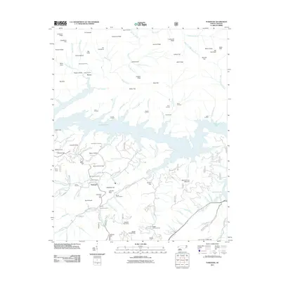
2011 Map of Tuskeegee
USGS Topo · Published 2011About this map
Tuskeegee and the settlement of Proctor are situated within a landscape defined by the expansive waters of Fontana Lake. This 2011 survey illustrates how the lake’s irregular shoreline winds through deep mountain coves like Coot Cove and Cable Cove, isolating various ridges and branches. The geography is marked by numerous family-named landmarks and historical burial grounds, including the Mitchell Cemetery, Welch Cemetery, and Pilkey Cemetery, which serve as critical markers of the local genealogy. High points such as The Pinnacle and Welch Bald overlook a complex network of waterways, from Hazel Creek to the South Fork Tuskeegee Creek. The presence of roads like Lower Sawyers Creek RD and Stecoah Heights RD shows the modern infrastructure connecting these mountain communities, while numerous small branches and hollows, such as Walnut Hollow and Possum Hollow, indicate the long-standing agricultural and residential patterns of this part of Graham County.
Find a feature on this map
115 named features on this map. Tap any name to fly to it.
Don’t see what you’re looking for? This feature index may not catch every label — zoom into the map to look around manually.
Map Details
Editions of this 2011 Tuskeegee Map
This is the sole edition of this map. No revisions or reprints were ever made.
Other maps of this area

1886 · Knoxville
USGS Topo · 1:125,000

1892 · Knoxville
USGS Topo · 1:125,000

1894 · Knoxville
USGS Topo · 1:125,000

1895 · Knoxville
USGS Topo · 1:125,000

1901 · Knoxville
USGS Topo · 1:125,000

1933 · Bushnell
USGS Topo · 1:62,500

1935 · Robbinsville
USGS Topo · 1:24,000

1935 · Fontana
USGS Topo · 1:24,000

1936 · Proctor
USGS Topo · 1:24,000

1936 · Wesser
USGS Topo · 1:24,000