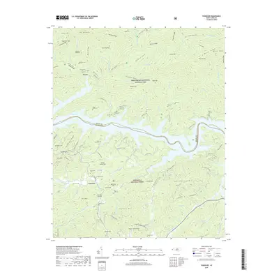
2019 Map of Tuskeegee
USGS Topo · Published 2019About this map
Proctor and Tuskeegee anchor a landscape defined by the convergence of the Great Smoky Mountains National Park and the Nantahala National Forest. The waters of Fontana Lake dominate the central valley, marking the boundary between Swain Co and Graham Co. This terrain is deeply inscribed with family history, evidenced by an exceptional density of remote burial grounds such as Bone Valley Cem, Nelms Family Cem, and the Welch - Kirkland Cem.
Find a feature on this map
131 named features on this map. Tap any name to fly to it.
Don’t see what you’re looking for? This feature index may not catch every label — zoom into the map to look around manually.
Map Details
Editions of this 2019 Tuskeegee Map
This is the sole edition of this map. No revisions or reprints were ever made.
Other maps of this area

1886 · Knoxville
USGS Topo · 1:125,000

1892 · Knoxville
USGS Topo · 1:125,000

1894 · Knoxville
USGS Topo · 1:125,000

1895 · Knoxville
USGS Topo · 1:125,000

1901 · Knoxville
USGS Topo · 1:125,000

1933 · Bushnell
USGS Topo · 1:62,500

1935 · Robbinsville
USGS Topo · 1:24,000

1935 · Fontana
USGS Topo · 1:24,000

1936 · Proctor
USGS Topo · 1:24,000

1936 · Wesser
USGS Topo · 1:24,000