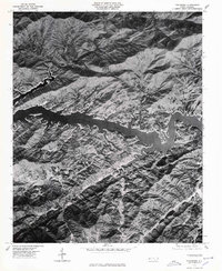
1976 Map of Tuskeegee
USGS Topo · Published 1978About this map
Tuskeegee is situated in the high elevations of the Great Smoky Mountains during the mid-1970s, as shown in this orthophotomap that reveals the dense forest canopy and steep terrain of Swain County. The deep waters of Fontana Lake dominate the central landscape, where the Little Tennessee River was transformed by the construction of the Fontana Dam. This aerial perspective provides a clear view of the winding shoreline and the numerous coves created by the flooded mountain valleys.
Find a feature on this map
7 named features on this map. Tap any name to fly to it.
Don’t see what you’re looking for? This feature index may not catch every label — zoom into the map to look around manually.
Map Details
Editions of this 1976 Tuskeegee Map
This is the sole edition of this map. No revisions or reprints were ever made.
Other maps of this area

1886 · Knoxville
USGS Topo · 1:125,000

1892 · Knoxville
USGS Topo · 1:125,000

1894 · Knoxville
USGS Topo · 1:125,000

1895 · Knoxville
USGS Topo · 1:125,000

1901 · Knoxville
USGS Topo · 1:125,000

1933 · Bushnell
USGS Topo · 1:62,500

1935 · Robbinsville
USGS Topo · 1:24,000

1935 · Fontana
USGS Topo · 1:24,000

1936 · Proctor
USGS Topo · 1:24,000

1936 · Wesser
USGS Topo · 1:24,000