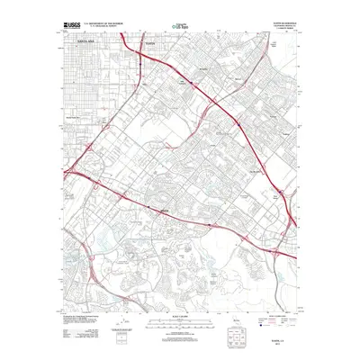
2012 Map of Tustin
USGS Topo · Published 2012About this map
Santa Ana and Tustin serve as the primary anchors for this highly developed corridor of Orange County in the early 21st century. The map illustrates a dense suburban and educational landscape, featuring the sprawling campus of the University of California - Irvine alongside Irvine Valley College and Concordia University - Irvine. Transportation infrastructure is a dominant theme, with the massive operations of John Wayne-Orange County Airport visible on the western edge and the intricate intersection of several major state and interstate highways. Smaller, localized settlements like Villa Valencia, The Meadows, and Myford are interspersed among the residential grids. The geography is defined by a network of engineered water channels such as the Peters Canyon Wash and San Diego Cr, which manage the drainage from the Little Joaquin Valley and the hills surrounding Bommer Canyon.
Find a feature on this map
49 named features on this map. Tap any name to fly to it.
Don’t see what you’re looking for? This feature index may not catch every label — zoom into the map to look around manually.
Map Details
Editions of this 2012 Tustin Map
This is the sole edition of this map. No revisions or reprints were ever made.
Other maps of this area

1896 · Santa Ana
USGS Topo · 1:62,500

1896 · Anaheim
USGS Topo · 1:62,500

1898 · Anaheim
USGS Topo · 1:62,500

1901 · Southern California Sheet No. 1
USGS Topo · 1:250,000

1901 · Santa Ana
USGS Topo · 1:62,500

1901 · Anaheim
USGS Topo · 1:62,500

1902 · Corona
USGS Topo · 1:125,000

1904 · Southern California Sheet No. 1
USGS Topo · 1:250,000

1932 · Orange
USGS Topo · 1:31,680

1932 · Newport Beach
USGS Topo · 1:31,680