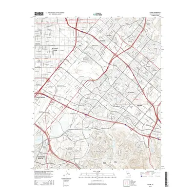
2015 Map of Tustin
USGS Topo · Published 2015About this map
Santa Ana and Tustin anchor this 2015 study of Orange County’s urban and academic corridor, where the residential grids of Villa Valencia and Aliso give way to the institutional campuses of the south. The University of California-Irvine and Concordia University dominate the southern landscape, situated just north of the rising San Joaquin Hills. This era of the region is defined by its extensive arterial road network, including the diagonal sweep of Jamboree Rd and MacArthur Blvd, connecting the commercial centers of Costa Mesa and the John Wayne Airport to the newer developments of Irvine.
Find a feature on this map
64 named features on this map. Tap any name to fly to it.
Don’t see what you’re looking for? This feature index may not catch every label — zoom into the map to look around manually.
Map Details
Editions of this 2015 Tustin Map
This is the sole edition of this map. No revisions or reprints were ever made.
Other maps of this area

1896 · Santa Ana
USGS Topo · 1:62,500

1896 · Anaheim
USGS Topo · 1:62,500

1898 · Anaheim
USGS Topo · 1:62,500

1901 · Southern California Sheet No. 1
USGS Topo · 1:250,000

1901 · Santa Ana
USGS Topo · 1:62,500

1901 · Anaheim
USGS Topo · 1:62,500

1902 · Corona
USGS Topo · 1:125,000

1904 · Southern California Sheet No. 1
USGS Topo · 1:250,000

1932 · Orange
USGS Topo · 1:31,680

1932 · Newport Beach
USGS Topo · 1:31,680