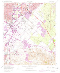
1962 Map of Tustin
USGS Topo · Published 1975About this map
Santa Ana and Tustin anchor the northwest corner of this mid-century landscape, capturing a pivotal moment of suburban expansion across the former agricultural lands of the Irvine Ranch. The map details the early development of the University of California (Irvine) and the Marine Corps Air Facility, illustrating the transition from open fields to institutional and residential centers. Transportation corridors define the area, from the tracks of the Atchison Topeka and Santa Fe at Irvine Siding to the burgeoning freeway network including the Santa Ana Freeway. To the east, the Lomas de Santiago and San Joaquin Hills rise above the drainage systems of San Diego Creek and Peters Canyon Wash, while small settlements like Frances and Kathryn sit along the rail lines before the major urban sprawl of later decades.
Find a feature on this map
91 named features on this map. Tap any name to fly to it.
Don’t see what you’re looking for? This feature index may not catch every label — zoom into the map to look around manually.
Map Details
Editions of this 1962 Tustin Map
This is the sole edition of this map. No revisions or reprints were ever made.
Other maps of this area

1896 · Santa Ana
USGS Topo · 1:62,500

1896 · Anaheim
USGS Topo · 1:62,500

1898 · Anaheim
USGS Topo · 1:62,500

1901 · Southern California Sheet No. 1
USGS Topo · 1:250,000

1901 · Santa Ana
USGS Topo · 1:62,500

1901 · Anaheim
USGS Topo · 1:62,500

1902 · Corona
USGS Topo · 1:125,000

1904 · Southern California Sheet No. 1
USGS Topo · 1:250,000

1932 · Orange
USGS Topo · 1:31,680

1932 · Newport Beach
USGS Topo · 1:31,680