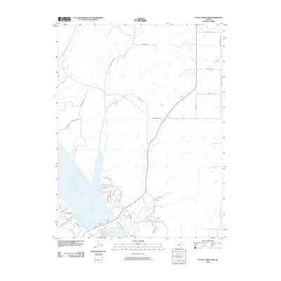
2009 Map of Tuttle Creek Dam
USGS Topo · Published 2009About this map
Tuttle Creek Lake dominates this landscape, its expansive waters held back by the massive engineering of the Tuttle Creek Dam. The shoreline is characterized by modern development and recreational infrastructure, notably around Spillway Marina Rd, Taylors View Rd, and the residential clusters along Washington Blvd. This 2009 survey illustrates how the Big Blue River valley was transformed by mid-century water management, creating a new geography of inlets and coves where creeks like Carnahan Creek and McIntyre Creek now meet the reservoir.
Find a feature on this map
38 named features on this map. Tap any name to fly to it.
Don’t see what you’re looking for? This feature index may not catch every label — zoom into the map to look around manually.
Map Details
Editions of this 2009 Tuttle Creek Dam Map
This is the sole edition of this map. No revisions or reprints were ever made.
Other maps of this area

1886 · Junction City
USGS Topo · 1:125,000

1889 · Wamego
USGS Topo · 1:125,000

1889 · Junction City
USGS Topo · 1:125,000

1894 · Junction City
USGS Topo · 1:125,000

1894 · Wamego
USGS Topo · 1:125,000

1947 · Manhattan
USGS Topo · 1:62,500

1950 · Keats
USGS Topo · 1:24,000

1950 · Manhattan
USGS Topo · 1:24,000

1953 · St George
USGS Topo · 1:24,000
1955 · Manhattan
USGS Topo · 1:24,000