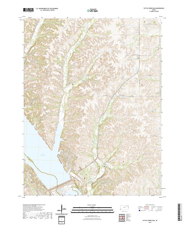
2022 Map of Tuttle Creek Dam
USGS Topo · Published 2022About this map
Tuttle Creek Lake dominates the southwestern portion of this landscape where the borders of Pottawatomie and Riley counties meet. The terrain is defined by a dense network of drainages including Carnahan Cr, McIntyre Cr, and Cedar Cr, which carve through the Kansas hills before reaching the reservoir. These waterways influenced the early layout of local roads and the placement of community landmarks, such as the Carnahan - Garrison Cem and Cedar Creek Cem, which remain as touchstones of the area's rural history.
Find a feature on this map
50 named features on this map. Tap any name to fly to it.
Don’t see what you’re looking for? This feature index may not catch every label — zoom into the map to look around manually.
Map Details
Editions of this 2022 Tuttle Creek Dam Map
This is the sole edition of this map. No revisions or reprints were ever made.
Other maps of this area

1886 · Junction City
USGS Topo · 1:125,000

1889 · Wamego
USGS Topo · 1:125,000

1889 · Junction City
USGS Topo · 1:125,000

1894 · Junction City
USGS Topo · 1:125,000

1894 · Wamego
USGS Topo · 1:125,000

1947 · Manhattan
USGS Topo · 1:62,500

1950 · Keats
USGS Topo · 1:24,000

1950 · Manhattan
USGS Topo · 1:24,000

1953 · St George
USGS Topo · 1:24,000
1955 · Manhattan
USGS Topo · 1:24,000