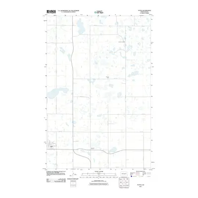
2011 Map of Tuttle
USGS Topo · Published 2011About this map
Tuttle anchors the southwestern corner of this Kidder County landscape, where the town's residential grid is defined by streets like Kidder St, N Prairie St, and 1st Ave. The surrounding prairie is a complex network of wetlands and small water bodies characteristic of the Missouri Coteau region, with Atwood Dam providing a distinct point of hydrological management. For those researching local heritage, the map identifies two significant burial sites: Saint Petri Cemetery in the northeast and Holy Cross Cemetery situated just east of the main settlement. The survey reflects a sparsely populated agricultural area organized by a rigid section-line road system, including routes such as 12th St SE and 29th Ave SE, which connect isolated farmsteads across the pothole-studded terrain.
Find a feature on this map
20 named features on this map. Tap any name to fly to it.
Don’t see what you’re looking for? This feature index may not catch every label — zoom into the map to look around manually.
Map Details
Editions of this 2011 Tuttle Map
This is the sole edition of this map. No revisions or reprints were ever made.
Other maps of this area

1952 · New Rockford
USGS Topo · 1:250,000

1954 · McClusky
USGS Topo · 1:250,000

1956 · New Rockford
USGS Topo · 1:250,000

1958 · McClusky
USGS Topo · 1:250,000

1971 · New Rockford
USGS Topo · 1:250,000

1972 · Tuttle
USGS Topo · 1:24,000
1972 · Horsehead Lake
USGS Topo · 1:24,000

1972 · Robinson
USGS Topo · 1:24,000
1972 · Tuttle SW
USGS Topo · 1:24,000
1978 · Willow Lake
USGS Topo · 1:24,000