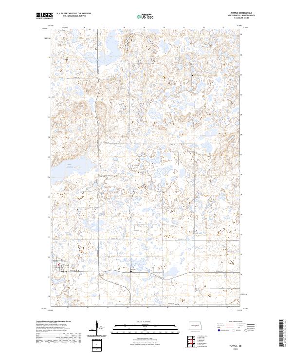
2024 Map of Tuttle
USGS Topo · Published 2024About this map
Tuttle serves as the primary settlement on this North Dakota prairie landscape, situated along the southern edge of a region defined by complex glacial topography. The town's grid, including Main St, 1st Ave, and 3rd Ave, reflects its role as a local center for the surrounding agricultural community. To the north, the terrain transitions into a dense network of wetlands and depressions, largely preserved within the Kidder County Waterfowl Production Area. This conservation area highlights the significance of the Central Flyway in this portion of Kidder County.
Find a feature on this map
29 named features on this map. Tap any name to fly to it.
Don’t see what you’re looking for? This feature index may not catch every label — zoom into the map to look around manually.
Map Details
Editions of this 2024 Tuttle Map
This is the sole edition of this map. No revisions or reprints were ever made.
Other maps of this area

1952 · New Rockford
USGS Topo · 1:250,000

1954 · McClusky
USGS Topo · 1:250,000

1956 · New Rockford
USGS Topo · 1:250,000

1958 · McClusky
USGS Topo · 1:250,000

1971 · New Rockford
USGS Topo · 1:250,000

1972 · Tuttle
USGS Topo · 1:24,000
1972 · Horsehead Lake
USGS Topo · 1:24,000

1972 · Robinson
USGS Topo · 1:24,000
1972 · Tuttle SW
USGS Topo · 1:24,000
1978 · Willow Lake
USGS Topo · 1:24,000