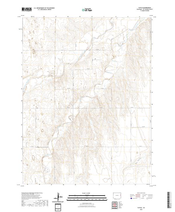
2022 Map of Tuttle
USGS Topo · Published 2022About this map
The South Fork Republican River winds through the northern sections of this High Plains landscape, defining the local hydrology alongside its smaller tributaries. This 2022 survey of Kit Carson County captures the orderly section-line grid of the Public Land Survey System, where roads like Co Rd 31 and Co Rd Hh follow strict cardinal directions across the terrain. The topography is marked by significant drainages including Spring Creek and the seasonally dry Dry Gulch in the southeast corner. This area remains primarily defined by its agricultural layout, with the vast majority of the map dedicated to open range and fields partitioned by a network of county roads. The drainage patterns of Spring Cr provide a natural contrast to the geometric precision of the township and range boundaries that organize this rural Colorado frontier.
Find a feature on this map
22 named features on this map. Tap any name to fly to it.
Don’t see what you’re looking for? This feature index may not catch every label — zoom into the map to look around manually.
Map Details
Editions of this 2022 Tuttle Map
This is the sole edition of this map. No revisions or reprints were ever made.
Other maps of this area

1954 · Limon
USGS Topo · 1:250,000

1957 · Limon
USGS Topo · 1:250,000

1958 · Limon
USGS Topo · 1:250,000

1969 · Settlement
USGS Topo · 1:24,000

1969 · Tuttle
USGS Topo · 1:24,000

1969 · Bethune
USGS Topo · 1:24,000

1969 · Idalia SW
USGS Topo · 1:24,000

1969 · Kirk
USGS Topo · 1:24,000

1969 · Stratton
USGS Topo · 1:24,000
1978 · Joes SW
USGS Topo · 1:24,000