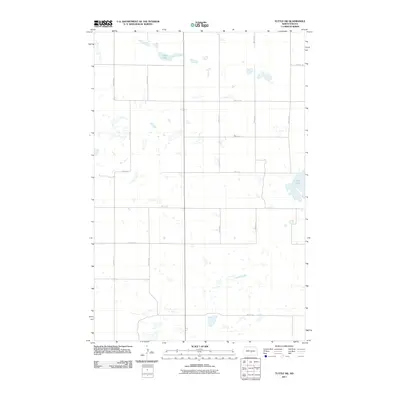
2011 Map of Tuttle SW
USGS Topo · Published 2011About this map
Clear Lake and the northern tip of Cherry Lake dominate this prairie landscape in Kidder County, where the topography is defined by the numerous small glacial potholes and wetlands characteristic of the Missouri Coteau region. This 2011 survey by the U.S. Geological Survey illustrates a highly structured rural grid of section-line roads, such as 21st St SE and 25th Ave SE, which divide the land into neat agricultural parcels. The lack of named settlements or civic institutions highlights the sparse, low-density nature of this agricultural area in central North Dakota during the early 21st century. Researchers can observe the interplay between these modern gravel thoroughfares and the irregular, natural water bodies that have resisted drainage, preserving the area's original hydrologic character.
Find a feature on this map
15 named features on this map. Tap any name to fly to it.
Don’t see what you’re looking for? This feature index may not catch every label — zoom into the map to look around manually.
Map Details
Editions of this 2011 Tuttle SW Map
This is the sole edition of this map. No revisions or reprints were ever made.
Other maps of this area

1951 · Driscoll
USGS Topo · 1:62,500

1952 · Steele NE
USGS Topo · 1:24,000

1952 · Steele NW
USGS Topo · 1:24,000

1952 · New Rockford
USGS Topo · 1:250,000

1953 · Jamestown
USGS Topo · 1:250,000

1954 · Bismarck
USGS Topo · 1:250,000

1954 · McClusky
USGS Topo · 1:250,000

1956 · New Rockford
USGS Topo · 1:250,000

1956 · Jamestown
USGS Topo · 1:250,000

1958 · Bismarck
USGS Topo · 1:250,000