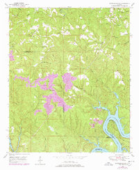
1949 Map of Tutwiler School
USGS Topo · Published 1978About this map
The Black Warrior River and the subsequent formation of Bankhead Lake dominate the southeastern corner of this landscape, where the borders of Walker, Tuscaloosa, and Jefferson counties converge. The terrain is a complex network of ridges and narrow valleys, defined by numerous waterways including White Oak Creek, Cedar Creek, and Indian Creek. Settlement patterns in the mid-20th century were dispersed, with small communities like Fairview, Browntown, and Canaan connected by winding roads through the hilly interior.
Find a feature on this map
41 named features on this map. Tap any name to fly to it.
Don’t see what you’re looking for? This feature index may not catch every label — zoom into the map to look around manually.
Map Details
Editions of this 1949 Tutwiler School Map
3 editions found

Other maps of this area

1893 · Jasper
USGS Topo · 1:125,000

1899 · Brookwood
USGS Topo · 1:125,000

1927 · Adger
USGS Topo · 1:48,000

1929 · Searles
USGS Topo · 1:48,000

1932 · Yolande
USGS Topo · 1:62,500

1934 · Searles
USGS Topo · 1:62,500

1935 · Port Birmingham
USGS Topo · 1:48,000

1935 · Yolande
USGS Topo · 1:62,500

1938 · Port Birmingham
USGS Topo · 1:62,500

1949 · Parrish
USGS Topo · 1:24,000