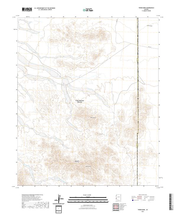
2021 Map of Tweed Mine
USGS Topo · Published 2021About this map
Chocolate Mountains terrain dominates this Southwestern landscape along the border of La Paz and Yuma counties. The topography is defined by the sharp transition from the flat expanse of the La Posa Plain in the northeast to the complex ridges and drainages of the main mountain range. Several geological landmarks are recorded, most notably a Natural Arch and the Tweed Mine, which sits tucked within the higher elevations. The drainage network is clearly articulated through prominent seasonal courses like Mohave Wash and Gould Wash, illustrating the arid-region watershed. Access to this remote area is primarily facilitated by Cibola Rd, which cuts across the northern edge of the desert flats, connecting the range to the surrounding basin.
Find a feature on this map
14 named features on this map. Tap any name to fly to it.
Don’t see what you’re looking for? This feature index may not catch every label — zoom into the map to look around manually.
Map Details
Editions of this 2021 Tweed Mine Map
This is the sole edition of this map. No revisions or reprints were ever made.
Other maps of this area

1934 · Trigo Peaks
USGS Topo · 1:48,000

1939 · Red Hill
USGS Topo · 1:62,500

1939 · Trigo Peaks
USGS Topo · 1:62,500

1942 · Blythe
USGS Topo · 1:250,000

1954 · Salton Sea
USGS Topo · 1:250,000

1954 · Red Hill
USGS Topo · 1:62,500

1954 · Trigo Peaks
USGS Topo · 1:62,500

1955 · Salton Sea
USGS Topo · 1:250,000

1959 · Salton Sea
USGS Topo · 1:250,000
1962 · Livingston Hills
USGS Topo · 1:62,500