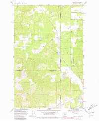
1968 Map of Tweedie
USGS Topo · Published 1981About this map
The borderlands of Washington and Idaho are defined here by a rugged landscape of national forest and state parkland, centered on the small settlement of Tweedie. The terrain transitions from the high peaks of Mt Sporane State Park in the southwest to the broad Blanchard Valley in the southeast. A significant industrial artery, the Chicago Milwaukee St Paul and Pacific railroad, cuts a diagonal path across the map, navigating the complex drainage systems of Elmer Creek and Blanchard Creek.
Find a feature on this map
23 named features on this map. Tap any name to fly to it.
Don’t see what you’re looking for? This feature index may not catch every label — zoom into the map to look around manually.
Map Details
Editions of this 1968 Tweedie Map
Other maps of this area

1901 · Sandpoint
USGS Topo · 1:125,000

1901 · Spokane
USGS Topo · 1:125,000

1903 · Rathdrum
USGS Topo · 1:125,000

1911 · Priest Lake
USGS Topo · 1:250,000

1911 · Sandpoint
USGS Topo · 1:125,000

1913 · Priest Lake
USGS Topo · 1:250,000

1936 · Newport
USGS Topo · 1:96,000

1942 · Newport
USGS Topo · 1:125,000

1943 · Mt Spokane
USGS Topo · 1:62,500

1950 · Mt Spokane
USGS Topo · 1:62,500