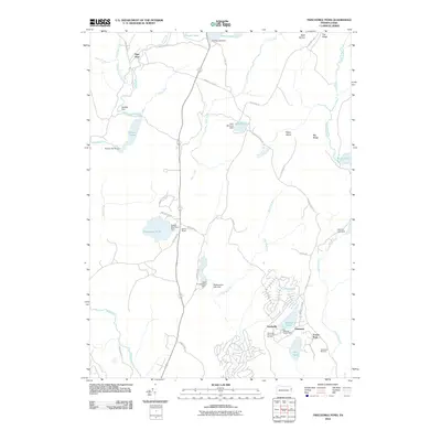
2010 Map of Twelvemile Pond
USGS Topo · Published 2010About this map
Twelvemile Pond and its namesake Twelve Mile Pond Dam anchor this Poconos landscape, reflecting a region defined by water management and seasonal recreation. To the south, the developments of Tamiment and Sandyville are adjacent to specialized leisure infrastructure, including the Tamiment Resort Golf Course and the Tamiment Ski Area. This 2010 survey illustrates a complex hydrological network where the Bush Kill and Little Bush Kill are regulated by a series of structures like the Maskenozha Lake Dam and Lehman Lake Dam. The settlement pattern varies from the clustered residences near First Pond and Second Pond to the more isolated outposts of Pine Flats and Hunters Range in the north. Significant terrain features such as Nebo Island and the elevated Big Ridge break the stream-fed lowlands, while historic routes like Old Shoehola Rd and Howeytown Rd provide the primary terrestrial links through the wooded townships.
Find a feature on this map
52 named features on this map. Tap any name to fly to it.
Don’t see what you’re looking for? This feature index may not catch every label — zoom into the map to look around manually.
Map Details
Editions of this 2010 Twelvemile Pond Map
This is the sole edition of this map. No revisions or reprints were ever made.
Other maps of this area

1891 · Wallpack
USGS Topo · 1:62,500

1893 · Wallpack
USGS Topo · 1:62,500

1913 · Milford
USGS Topo · 1:62,500

1915 · Milford
USGS Topo · 1:62,500

1924 · Bushkill
USGS Topo · 1:48,000

1935 · Hawley
USGS Topo · 1:62,500

1938 · Hawley
USGS Topo · 1:62,500

1943 · Bushkill
USGS Topo · 1:62,500

1943 · Lake Maskenozha
USGS Topo · 1:31,680
1943 · Flatbrookville
USGS Topo · 1:31,680
Featured Places
- Middle Smithfield Township, PA
- Lehman Township, PA
- Sandyville, Lehman Township
- Tamiment, Lehman Township
- Forest Park, Lehman Township