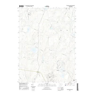
2016 Map of Twelvemile Pond
USGS Topo · Published 2016About this map
Saw Creek flows through a landscape defined by its complex hydrology and dense upland plateaus along the boundary of Pike and Monroe Counties. The settlement of Saw Creek anchoring the south represents modern residential development, while the northern reaches maintain a more wild character dominated by expansive wetlands like Ben Hanna Swamp, Nebo Swamp, and Big Swamp. These swampy depressions are interspersed between prominent ridges such as Bald Barren and Big Ridge, creating a distinctive pattern of alternating high ground and water-saturated basins.
Find a feature on this map
75 named features on this map. Tap any name to fly to it.
Don’t see what you’re looking for? This feature index may not catch every label — zoom into the map to look around manually.
Map Details
Editions of this 2016 Twelvemile Pond Map
This is the sole edition of this map. No revisions or reprints were ever made.
Other maps of this area

1891 · Wallpack
USGS Topo · 1:62,500

1893 · Wallpack
USGS Topo · 1:62,500

1913 · Milford
USGS Topo · 1:62,500

1915 · Milford
USGS Topo · 1:62,500

1924 · Bushkill
USGS Topo · 1:48,000

1935 · Hawley
USGS Topo · 1:62,500

1938 · Hawley
USGS Topo · 1:62,500

1943 · Bushkill
USGS Topo · 1:62,500

1943 · Lake Maskenozha
USGS Topo · 1:31,680
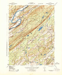
1943 · Flatbrookville
USGS Topo · 1:31,680
Featured Places
- Middle Smithfield Township, PA
- Lehman Township, PA
- Sandyville, Lehman Township
- Tamiment, Lehman Township
- Forest Park, Lehman Township