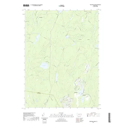
2019 Map of Twelvemile Pond
USGS Topo · Published 2019About this map
Pine Flats and the residential clusters of Sandyville and Tamiment anchor this 2019 study of the Pocono plateau along the border of Pike and Monroe Counties. The landscape is dominated by a complex network of wetlands and glacial lakes, including Twelvemile Pond, Lake Minisink, and the First Pond, Second Pond, and Third Pond series. This modern survey illustrates the transition from the secluded marshes of the north, such as Bobs String Swamp and Elbow Swamp, to the developed residential corridors in the south.
Find a feature on this map
91 named features on this map. Tap any name to fly to it.
Don’t see what you’re looking for? This feature index may not catch every label — zoom into the map to look around manually.
Map Details
Editions of this 2019 Twelvemile Pond Map
This is the sole edition of this map. No revisions or reprints were ever made.
Other maps of this area

1891 · Wallpack
USGS Topo · 1:62,500

1893 · Wallpack
USGS Topo · 1:62,500

1913 · Milford
USGS Topo · 1:62,500

1915 · Milford
USGS Topo · 1:62,500

1924 · Bushkill
USGS Topo · 1:48,000

1935 · Hawley
USGS Topo · 1:62,500

1938 · Hawley
USGS Topo · 1:62,500

1943 · Bushkill
USGS Topo · 1:62,500

1943 · Lake Maskenozha
USGS Topo · 1:31,680
1943 · Flatbrookville
USGS Topo · 1:31,680
Featured Places
- Middle Smithfield Township, PA
- Lehman Township, PA
- Sandyville, Lehman Township
- Tamiment, Lehman Township
- Forest Park, Lehman Township