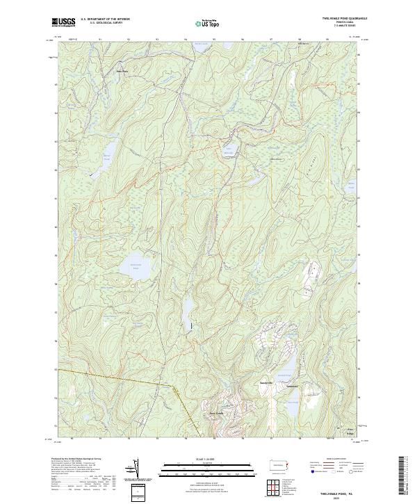
2023 Map of Twelvemile Pond
USGS Topo · Published 2023About this map
Twelvemile Pond and its surrounding wetlands form the center of this high-plateau landscape along the Pike and Monroe county line. The terrain is defined by an intricate network of marshes and water bodies, including Big Swamp, Elbow Swamp, and Turner Swamp, which feed into the Bush Kill and Beaver Run. This environment reflects the glaciated history of the Poconos, where numerous ponds like Minks Pond and Lehman Lake are interspersed with distinct ridges such as Big Ridge and Flat Ridge.
Find a feature on this map
91 named features on this map. Tap any name to fly to it.
Don’t see what you’re looking for? This feature index may not catch every label — zoom into the map to look around manually.
Map Details
Editions of this 2023 Twelvemile Pond Map
This is the sole edition of this map. No revisions or reprints were ever made.
Other maps of this area

1891 · Wallpack
USGS Topo · 1:62,500

1893 · Wallpack
USGS Topo · 1:62,500

1913 · Milford
USGS Topo · 1:62,500

1915 · Milford
USGS Topo · 1:62,500

1924 · Bushkill
USGS Topo · 1:48,000

1935 · Hawley
USGS Topo · 1:62,500

1938 · Hawley
USGS Topo · 1:62,500

1943 · Bushkill
USGS Topo · 1:62,500

1943 · Lake Maskenozha
USGS Topo · 1:31,680
1943 · Flatbrookville
USGS Topo · 1:31,680
Featured Places
- Delaware Township, PA
- Porter Township, PA
- Sandyville, Lehman Township
- Tamiment, Lehman Township
- Pine Flats, Porter Township