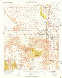
1955 Map of Twentynine Palms
USGS Topo · Published 1956About this map
Twentynine Palms and its surrounding high-desert landscape are documented here during a period of significant military and park expansion in the mid-1950s. The map illustrates the burgeoning community center at The Plaza and the nearby Marine Corps Training Center, contrasting these modern developments with the long-established Twentynine Palms Indian Res. To the south, the boundary of Joshua Tree National Monument encompasses a labyrinth of geologic features, from the massive boulders of Indian Cove and Split Rock to the prominent heights of Queen Mountain and Quail Mtn. Historical land use is visible through markers like the Desert Queen Mine and Barker Dam, which highlight the region's ranching and prospecting heritage. Notable desert water sources, including the Fortynine Palms Oasis and Willow Hole, are identified alongside early infrastructure such as the Amboy Road and Bagdad Road.
Find a feature on this map
51 named features on this map. Tap any name to fly to it.
Don’t see what you’re looking for? This feature index may not catch every label — zoom into the map to look around manually.
Map Details
Editions of this 1955 Twentynine Palms Map
5 editions found

Other maps of this area

1941 · Edom
USGS Topo · 1:62,500

1942 · Amboy
USGS Topo · 1:250,000

1943 · Amboy
USGS Topo · 1:250,000

1943 · Pinkham Well
USGS Topo · 1:62,500

1944 · Pinkham Well
USGS Topo · 1:62,500

1944 · Edom
USGS Topo · 1:62,500

1944 · Pinyon Well
USGS Topo · 1:62,500

1947 · Santa Ana
USGS Topo · 1:250,000

1949 · Santa Ana
USGS Topo · 1:250,000

1953 · San Bernardino
USGS Topo · 1:250,000
Featured Places
- Twentynine Palms, CA
- Desert Heights, CA
- Sunfair Heights, CA
- Panorama Heights, CA
- Smoke Tree, Twentynine Palms