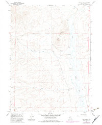
1967 Map of Twin Buttes
USGS Topo · Published 1983About this map
Marys River snakes through this high desert landscape, carving a fertile corridor for cattle operations in Elko County. The Cross Ranch sits near the riverbanks, supported by a Water Tank and several Hot Springs that dot the valley floor. The geography is defined by the prominent silhouette of Twin Buttes to the north, which overlooks the convergence of Pole Creek, Allen Creek, and Gopher Creek. These seasonal drainages suggest a remote ranching economy dependent on reliable water sources and clear topographical markers. Evidence of deeper land use appears with the Salt Block Well in the southwest, likely serving livestock or mineral interests. The 1982 photorevisions reflect subtle changes in fencing and unimproved roads, illustrating how little the fundamental ranching infrastructure of this Great Basin territory altered during the mid-to-late 20th century.
Find a feature on this map
14 named features on this map. Tap any name to fly to it.
Don’t see what you’re looking for? This feature index may not catch every label — zoom into the map to look around manually.
Map Details
Editions of this 1967 Twin Buttes Map
2 editions found
Other maps of this area

1955 · Wells
USGS Topo · 1:250,000

1958 · Wells
USGS Topo · 1:250,000

1961 · Wells
USGS Topo · 1:250,000

1967 · Hanks Creek SW
USGS Topo · 1:24,000

1967 · Black Butte SW
USGS Topo · 1:24,000

1967 · Hot Springs Creek
USGS Topo · 1:24,000

1967 · Twin Buttes
USGS Topo · 1:24,000

1967 · Peko Peak
USGS Topo · 1:24,000

1967 · Herder Creek
USGS Topo · 1:24,000
1967 · Deeth
USGS Topo · 1:24,000