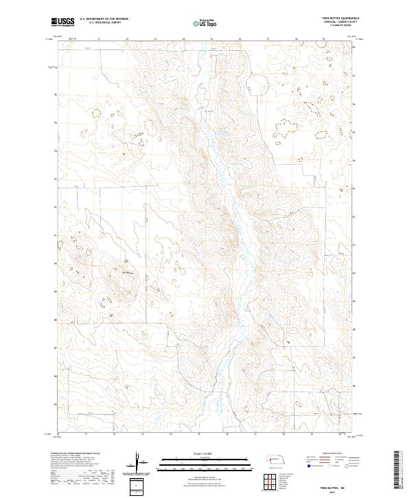
2021 Map of Twin Buttes
USGS Topo · Published 2021About this map
Twin Buttes rises as a prominent landmark in this section of Garden County, Nebraska, where the arid high plains meet a sophisticated network of early twentieth-century water management. The landscape is defined by the winding course of Blue Cr, which is supported by a series of irrigation works including the Hooper Canal, Paisley Canal, and Blue Canal. These man-made waterways indicate the area's agricultural history, transforming the natural drainage patterns of Ash Cr and the intermittent flows from Rattlesnake Spring and Dugout Spring into a productive landscape. A strictly organized grid of county roads, such as RD 70 and RD 201, provides the primary framework for local travel across the sprawling ranchland and township sections.
Find a feature on this map
27 named features on this map. Tap any name to fly to it.
Don’t see what you’re looking for? This feature index may not catch every label — zoom into the map to look around manually.
Map Details
Editions of this 2021 Twin Buttes Map
This is the sole edition of this map. No revisions or reprints were ever made.
Other maps of this area

1900 · Chappell
USGS Topo · 1:125,000

1949 · Rackett
USGS Topo · 1:62,500

1950 · Crescent Lake
USGS Topo · 1:62,500

1951 · Rackett
USGS Topo · 1:62,500

1954 · Scottsbluff
USGS Topo · 1:250,000

1958 · Scottsbluff
USGS Topo · 1:250,000
1971 · Twin Buttes
USGS Topo · 1:24,000
1971 · Ruthton
USGS Topo · 1:24,000

1971 · Barn Butte
USGS Topo · 1:24,000
1971 · Old Baldy
USGS Topo · 1:24,000