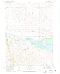
1971 Map of Ruthton
USGS Topo · Published 1974About this map
The Oregon Trail cuts through this high plains landscape, descending past the famous Windlass Hill toward the valley of the North Platte River. This corridor was vital to western migration, evidenced here by the preservation of Ash Hollow State Historical Park and landmarks like Ash Hollow Cave. The map captures the area during the early 1970s, where the western reaches of Lake McConaughy meet the Clear Creek State Waterfowl Management Area, creating a complex wetland environment in the river's flood plain.
Find a feature on this map
32 named features on this map. Tap any name to fly to it.
Don’t see what you’re looking for? This feature index may not catch every label — zoom into the map to look around manually.
Map Details
Editions of this 1971 Ruthton Map
This is the sole edition of this map. No revisions or reprints were ever made.
Other maps of this area

1897 · Ogallala
USGS Topo · 1:125,000

1900 · Chappell
USGS Topo · 1:125,000

1900 · Ogallala
USGS Topo · 1:125,000

1954 · Scottsbluff
USGS Topo · 1:250,000

1954 · North Platte
USGS Topo · 1:250,000

1956 · North Platte
USGS Topo · 1:250,000

1957 · North Platte
USGS Topo · 1:250,000

1958 · Scottsbluff
USGS Topo · 1:250,000

1967 · North Platte
USGS Topo · 1:250,000
1971 · Brule NW
USGS Topo · 1:24,000