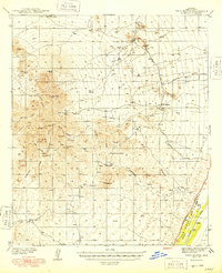
1948 Map of Twin Buttes
USGS Topo · Published 1948About this map
The Sierrita Mountains dominate the western half of this 1930s survey, a landscape defined by ranching life and mining prospects before the mid-century expansion of modern infrastructure. Settlements such as Soto Ranch and Pino Blanco Ranch are situated near vital water sources like Ash Creek and numerous tanks, highlighting the critical nature of water management in the desert. In the east, the Southern Pacific railroad follows the path of the Santa Cruz River through the San Ignacio De La Canoa land grant, connecting the settlement of Canoa to the regional network. The presence of the McGee Sch and various mining sites near Mineral Hill and Twin Buttes suggests a community supported by both traditional agriculture and the extraction of mineral wealth during the late Depression era.
Find a feature on this map
47 named features on this map. Tap any name to fly to it.
Don’t see what you’re looking for? This feature index may not catch every label — zoom into the map to look around manually.
Map Details
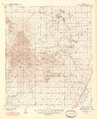
Editions of this 1948 Twin Buttes Map
2 editions found
Other maps of this area

1904 · Patagonia
USGS Topo · 1:125,000

1904 · Tucson
USGS Topo · 1:125,000

1905 · Patagonia
USGS Topo · 1:125,000

1905 · Tucson
USGS Topo · 1:125,000

1920 · Arivaca
USGS Topo · 1:125,000

1922 · Agus Caliente
USGS Topo · 1:62,500

1925 · Samaniego Peak
USGS Topo · 1:62,500

1925 · San Xavier
USGS Topo · 1:62,500

1926 · Helvetia
USGS Topo · 1:62,500

1934 · Tucson Mountains
USGS Topo · 1:125,000