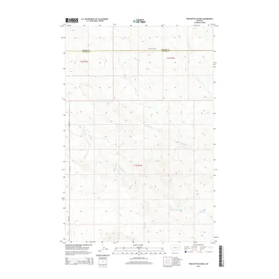
2014 Map of Twin Buttes School
USGS Topo · Published 2014About this map
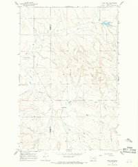
Twin Buttes School stands as a lonely landmark near the Prairie Co / Custer Co line in this sparsely settled region of eastern Montana. The landscape is defined by an intricate network of drainages, where Hay Cr and Finley Cr carve through the terrain. To the south, the headwaters of N Fork Bachelor Cr and S Fork Bachelor Cr converge toward the Hamlick Reservoir, a rare point of water collection in this arid ranching country. Transportation is dominated by the long stretch of Deadman Rd, which runs north-to-south along the western edge of the quadrangle. The map reveals the classic township and range system typical of the American West, with sections like t13n r46e and t12n r46e illustrating how land was surveyed and partitioned for homesteading and grazing.
Find a feature on this map
15 named features on this map. Tap any name to fly to it.
Don’t see what you’re looking for? This feature index may not catch every label — zoom into the map to look around manually.
Map Details
Editions of this 2014 Twin Buttes School Map
This is the sole edition of this map. No revisions or reprints were ever made.
Other maps of this area

1953 · Miles City
USGS Topo · 1:250,000

1954 · Forsyth
USGS Topo · 1:250,000

1957 · Miles City
USGS Topo · 1:250,000

1957 · Forsyth
USGS Topo · 1:250,000

1958 · Miles City
USGS Topo · 1:250,000

1958 · Forsyth
USGS Topo · 1:250,000
1965 · Little Sheep Mountain
USGS Topo · 1:24,000
1965 · Twin Buttes School
USGS Topo · 1:24,000
1965 · Combs Ranch
USGS Topo · 1:24,000
1965 · Crow Rock
USGS Topo · 1:24,000