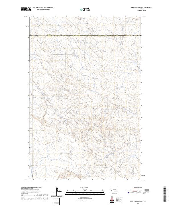
2024 Map of Twin Buttes School
USGS Topo · Published 2024About this map
Crow Rock Creek and the headwaters of the North Fork Bachelor Creek define this section of the Montana rangeland along the border of Prairie and Custer Counties. This 2024 landscape is characterized by its complex drainage network, where seasonal waterways like Hay Creek and Finley Creek have carved a dense system of coulees and ridges. Minimal human infrastructure is present, limited primarily to remote arteries such as Deadman Rd and Rd 102. The survey captures the intricate topography of the Big Dry country, showing how water moves through South Fork Bachelor Creek and Grimes Creek toward the larger basins. It is a detailed modern record of land divisions and the natural hydrography of an area dominated by open range and large-scale ranching geography.
Find a feature on this map
14 named features on this map. Tap any name to fly to it.
Don’t see what you’re looking for? This feature index may not catch every label — zoom into the map to look around manually.
Map Details
Editions of this 2024 Twin Buttes School Map
This is the sole edition of this map. No revisions or reprints were ever made.
Other maps of this area

1953 · Miles City
USGS Topo · 1:250,000

1954 · Forsyth
USGS Topo · 1:250,000

1957 · Miles City
USGS Topo · 1:250,000

1957 · Forsyth
USGS Topo · 1:250,000

1958 · Miles City
USGS Topo · 1:250,000

1958 · Forsyth
USGS Topo · 1:250,000

1965 · Little Sheep Mountain
USGS Topo · 1:24,000

1965 · Twin Buttes School
USGS Topo · 1:24,000
1965 · Combs Ranch
USGS Topo · 1:24,000
1965 · Crow Rock
USGS Topo · 1:24,000