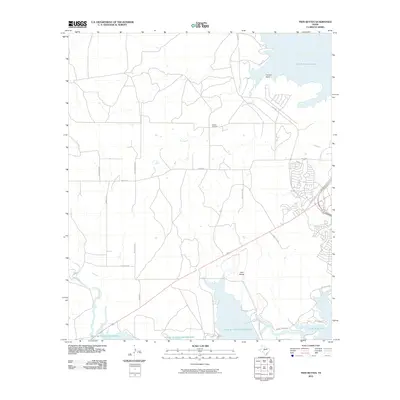
2010 Map of Twin Buttes
USGS Topo · Published 2010About this map
Twin Buttes Reservoir and the surrounding Concho River forks dominate this 2010 landscape west of San Angelo. The map documents the convergence of the Middle Concho River and the South Concho River, showing the extensive water management infrastructure that characterizes this semi-arid region. To the north and east, the shorelines of O C Fisher Lake and Lake Nasworthy provide further evidence of the area's developed hydrology.
Find a feature on this map
23 named features on this map. Tap any name to fly to it.
Don’t see what you’re looking for? This feature index may not catch every label — zoom into the map to look around manually.
Map Details
Editions of this 2010 Twin Buttes Map
This is the sole edition of this map. No revisions or reprints were ever made.
Other maps of this area

1891 · Hayrick
USGS Topo · 1:125,000

1892 · San Angelo
USGS Topo · 1:125,000

1894 · Hayrick
USGS Topo · 1:125,000

1895 · Sherwood
USGS Topo · 1:125,000

1924 · San Angelo 2-c
USGS Topo · 1:48,000

1924 · Sherwood 1-d
USGS Topo · 1:48,000

1924 · San Angelo 2-b
USGS Topo · 1:48,000

1924 · Sherwood 1-a
USGS Topo · 1:48,000

1928 · Wall
USGS Topo · 1:62,500

1928 · Tankersly
USGS Topo · 1:62,500