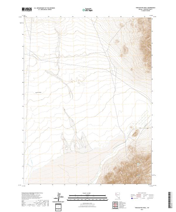
2021 Map of Twin Buttes Well
USGS Topo · Published 2021About this map
Kumiva Valley dominates this Pershing County landscape, positioned between the striking elevations of the Hannan Range to the northeast and the Blue Wing Mountains to the south. This 2021 survey documents the complex drainage patterns of the high desert, where seasonal watercourses like Missouri Cr and Betty Cr transition from mountain slopes into the valley floor. The map serves as a detailed record of remote basin-and-range topography, illustrating the stark relief and isolated water sources like Black Mountain Spring. Accessibility is limited primarily to State Hwy 399, which cuts across the southeastern corner of the quadrangle. This modern survey provides an essential topographic baseline for understanding the hydrologic and geological character of this arid interior region of Nevada.
Find a feature on this map
13 named features on this map. Tap any name to fly to it.
Don’t see what you’re looking for? This feature index may not catch every label — zoom into the map to look around manually.
Map Details
Editions of this 2021 Twin Buttes Well Map
This is the sole edition of this map. No revisions or reprints were ever made.
Other maps of this area

1886 · Granite Range
USGS Topo · 1:250,000

1894 · Granite Range
USGS Topo · 1:250,000

1931 · Lovelock
USGS Topo · 1:250,000

1935 · Lovelock
USGS Topo · 1:250,000

1955 · Lovelock
USGS Topo · 1:250,000

1959 · Lovelock
USGS Topo · 1:250,000

1980 · Eagle Rock Spring
USGS Topo · 1:24,000

1980 · Tenmile
USGS Topo · 1:24,000

1981 · Twin Buttes Well
USGS Topo · 1:24,000

1981 · Gerlach
USGS Topo · 1:100,000