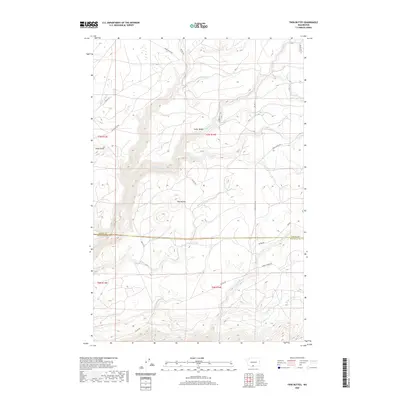
2020 Map of Twin Buttes
USGS Topo · Published 2020About this map
The boundary between Yakima and Klickitat counties cuts through this high-altitude landscape, where several mountain creeks originate. Significant elevations are defined by the peaks of Twin Buttes and Klose Butte, with the latter accessible via Klose Butte Rd. The topography is a complex network of drainages including Summit Cr and White Cr, which carve through the terrain near Cedar Valley.
Find a feature on this map
27 named features on this map. Tap any name to fly to it.
Don’t see what you’re looking for? This feature index may not catch every label — zoom into the map to look around manually.
Map Details
Editions of this 2020 Twin Buttes Map
This is the sole edition of this map. No revisions or reprints were ever made.
Other maps of this area

1904 · Mount Adams
USGS Topo · 1:125,000

1907 · Mount Adams
USGS Topo · 1:125,000

1934 · The Dalles
USGS Topo · 1:125,000

1937 · White Swan
USGS Topo · 1:125,000

1950 · Yakima
USGS Topo · 1:250,000

1953 · The Dalles
USGS Topo · 1:250,000

1956 · The Dalles
USGS Topo · 1:250,000

1957 · The Dalles
USGS Topo · 1:250,000

1957 · Klickitat
USGS Topo · 1:62,500

1957 · Goldendale
USGS Topo · 1:62,500