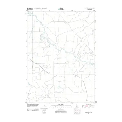
2010 Map of Twin Falls NE
USGS Topo · Published 2010About this map
North Side Main Canal and a complex web of tributary waterways dictate the settlement and agricultural patterns of this Jerome County landscape. The geography is defined by its industrial irrigation infrastructure, with the F Canal, G Canal, and H Canal carving a geometric grid across the plains. These engineered water courses support the small communities of Perrine and Hunt, which serve as anchors for the surrounding rural road network. The map reveals the precise intersection of early 21st-century infrastructure and desert reclamation, showing how the primary canal system bifurcates the terrain. Local history researchers can trace the development of this region through its specifically named arterial routes, such as Hunt Rd and the meticulously labeled section lines like S 1000 E, which reflect the systematic organization of Idaho's agricultural interior.
Find a feature on this map
25 named features on this map. Tap any name to fly to it.
Don’t see what you’re looking for? This feature index may not catch every label — zoom into the map to look around manually.
Map Details
Editions of this 2010 Twin Falls NE Map
This is the sole edition of this map. No revisions or reprints were ever made.
Other maps of this area

1955 · Twin Falls
USGS Topo · 1:250,000

1958 · Twin Falls
USGS Topo · 1:250,000

1964 · Kimberly
USGS Topo · 1:24,000

1964 · Falls City
USGS Topo · 1:24,000

1964 · Twin Falls
USGS Topo · 1:24,000

1964 · Eden
USGS Topo · 1:24,000

1964 · Perrine
USGS Topo · 1:24,000

1964 · Hunt
USGS Topo · 1:24,000

1971 · Shoshone SE
USGS Topo · 1:24,000

1971 · Star Lake
USGS Topo · 1:24,000