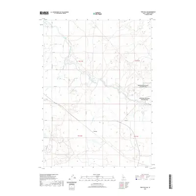
2020 Map of Twin Falls NE
USGS Topo · Published 2020About this map
Minidoka National Historic Site occupies a significant portion of this Jerome County landscape, marking the grounds of the former World War II incarceration camp. The surrounding terrain is defined by a dense network of irrigation infrastructure essential to the Snake River Plain, featuring the winding North Side Main Canal and its numerous smaller offshoots like the F Canal, E Canal, and L Canal. These waterways dictate the local geography, cutting across a grid of rural roads such as Sugar Loaf Rd and Perrine Rd. Near the center of the sheet, the small settlement of Perrine sits among these agricultural channels. The map demonstrates the complex plumbing of the desert, where features like the PD-5 Ditch and various laterals support the regional farm economy east of the major city center.
Find a feature on this map
29 named features on this map. Tap any name to fly to it.
Don’t see what you’re looking for? This feature index may not catch every label — zoom into the map to look around manually.
Map Details
Editions of this 2020 Twin Falls NE Map
This is the sole edition of this map. No revisions or reprints were ever made.
Other maps of this area

1955 · Twin Falls
USGS Topo · 1:250,000

1958 · Twin Falls
USGS Topo · 1:250,000

1964 · Kimberly
USGS Topo · 1:24,000

1964 · Falls City
USGS Topo · 1:24,000

1964 · Twin Falls
USGS Topo · 1:24,000

1964 · Eden
USGS Topo · 1:24,000

1964 · Perrine
USGS Topo · 1:24,000

1964 · Hunt
USGS Topo · 1:24,000

1971 · Shoshone SE
USGS Topo · 1:24,000

1971 · Star Lake
USGS Topo · 1:24,000