
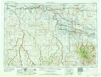
1958 Map of Twin Falls
USGS Topo · Published 1958About this map
The Snake River carves a deep path across this mid-century survey, anchoring a landscape where agricultural irrigation meets high-desert military operations. The complex network of the Milner Gooding Canal and various river diversions supports established settlements like Twin Falls, Jerome, and Buhl, illustrating the transformation of the Snake River Plain. In contrast, the southern and western reaches of the sheet are defined by the expansive Saylor Creek Aerial Gunnery Range and the remote high country of the Sawtooth National Forest.
Find a feature on this map
68 named features on this map. Tap any name to fly to it.
Don’t see what you’re looking for? This feature index may not catch every label — zoom into the map to look around manually.
Map Details
Editions of this 1958 Twin Falls Map
2 editions found
Other maps of this area

1892 · Mountain Home
USGS Topo · 1:125,000

1892 · Bisuka
USGS Topo · 1:125,000

1892 · Camas Prairie
USGS Topo · 1:125,000

1893 · Mountain Home
USGS Topo · 1:125,000

1893 · Camas Prairie
USGS Topo · 1:125,000

1894 · Bisuka
USGS Topo · 1:125,000

1936 · Mountain City
USGS Topo · 1:62,500

1936 · Rowland
USGS Topo · 1:48,000

1939 · Owyhee
USGS Topo · 1:62,500

1940 · Rowland
USGS Topo · 1:62,500