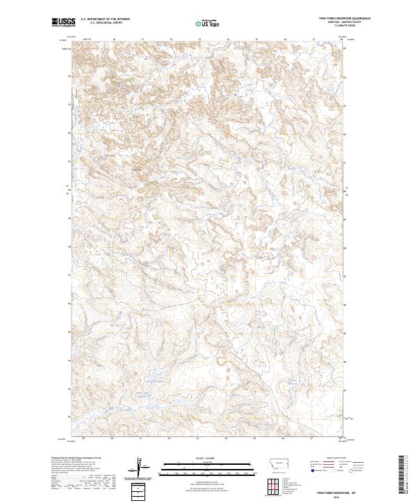
2024 Map of Twin Forks Reservoir
USGS Topo · Published 2024About this map
Twin Forks Reservoir and Gagena Reservoir sit at the center of this Dawson County landscape, illustrating the critical role of water management in eastern Montana. The terrain is defined by the elevation of Blue Mtn and a network of drainages including Frank Creek and Magpie Creek. This modern survey details the infrastructure of the high plains, where the Labelle Ditch and Upper Labell Reservoir facilitate the movement of water across a sparsely populated agricultural and ranching interior. Located in the sections of t14n r56e and t13n r57e, the map traces the subtle contours of the badlands and coulees that feed into Glendive Creek in the northeastern corner. This topographic study is an essential resource for understanding how land use and water storage continue to shape this portion of the Montana prairie.
Find a feature on this map
13 named features on this map. Tap any name to fly to it.
Don’t see what you’re looking for? This feature index may not catch every label — zoom into the map to look around manually.
Map Details
Editions of this 2024 Twin Forks Reservoir Map
This is the sole edition of this map. No revisions or reprints were ever made.
Other maps of this area

1909 · Glendive
USGS Topo · 1:250,000

1953 · Miles City
USGS Topo · 1:250,000

1954 · Glendive
USGS Topo · 1:250,000

1957 · Miles City
USGS Topo · 1:250,000

1957 · Glendive
USGS Topo · 1:250,000

1958 · Miles City
USGS Topo · 1:250,000

1958 · Glendive
USGS Topo · 1:250,000

1967 · Allard
USGS Topo · 1:24,000
1967 · Glendive
USGS Topo · 1:24,000
1967 · Upper Magpie Reservoir
USGS Topo · 1:24,000