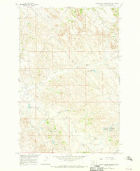
1967 Map of Upper Magpie Reservoir
USGS Topo · Published 1970About this map
The Gas City Oil Field dominates this eastern Montana landscape, illustrating the industrial footprint of petroleum development in Dawson County during the mid-1960s. A network of pipelines and scattered Oil Wells cross-cut the drainage basins of Magpie Creek and Cedar Creek. The terrain is defined by its water management infrastructure, featuring a high density of small earthen structures such as Gertison Dam, Jumper Dam, and Basin View Dam which supported local ranching and industry.
Find a feature on this map
19 named features on this map. Tap any name to fly to it.
Don’t see what you’re looking for? This feature index may not catch every label — zoom into the map to look around manually.
Map Details
Editions of this 1967 Upper Magpie Reservoir Map
This is the sole edition of this map. No revisions or reprints were ever made.
Other maps of this area

1909 · Glendive
USGS Topo · 1:250,000

1953 · Miles City
USGS Topo · 1:250,000

1954 · Glendive
USGS Topo · 1:250,000

1957 · Miles City
USGS Topo · 1:250,000

1957 · Glendive
USGS Topo · 1:250,000

1958 · Miles City
USGS Topo · 1:250,000

1958 · Glendive
USGS Topo · 1:250,000

1967 · Allard
USGS Topo · 1:24,000

1967 · Hoyt
USGS Topo · 1:24,000
1967 · Glendive
USGS Topo · 1:24,000