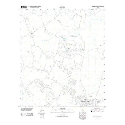
2010 Map of Twin Mountains
USGS Topo · Published 2010About this map
Copperas Cove occupies the southeastern corner of this Central Texas landscape, marking the edge of a growing urban footprint that meets a series of distinctive limestone uplands. The terrain is defined by a cluster of named peaks including Herzog Mountain, Long Mountain, and Hog Mountain, which create a natural barrier between the city and the rural expanses to the northwest. These elevations, along with Beecham Gap and the Twin Mountains themselves, dictate the drainage patterns of several local waterways such as Taylor Creek and Settlement Branch.
Find a feature on this map
63 named features on this map. Tap any name to fly to it.
Don’t see what you’re looking for? This feature index may not catch every label — zoom into the map to look around manually.
Map Details
Editions of this 2010 Twin Mountains Map
This is the sole edition of this map. No revisions or reprints were ever made.
Other maps of this area

1887 · Lampasas
USGS Topo · 1:125,000

1894 · Lampasas
USGS Topo · 1:125,000

1894 · Gatesville
USGS Topo · 1:125,000

1947 · Fort Hood
USGS Topo · 1:62,500

1947 · Fort Hood
USGS Topo · 1:24,000

1947 · Purmela
USGS Topo · 1:62,500

1947 · McMillan Mountains
USGS Topo · 1:24,000

1947 · Pidcoke
USGS Topo · 1:24,000

1947 · Shell Mountains
USGS Topo · 1:24,000

1947 · Twin Moutains
USGS Topo · 1:24,000