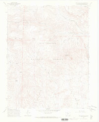
1967 Map of Twin Mountains
USGS Topo · Published 1969About this map
Rio Grande National Forest dominates this 1967 survey, where high-altitude drainages and geological landmarks define the Saguache County terrain. The landscape is marked by a network of seasonal and perennial water sources, including La Garita Creek and Old Woman Creek, which are supplemented by named watering points like Usevia Springs and Sunday Spring. This area reflects a history of itinerant land use rather than permanent settlement, evidenced by the presence of a Stock Driveway, Pack Trail, and various Jeep Trails that navigate the slopes between Blue Mountain and Eagle Mountain. Mining history is visible in the scattered Prospects located near the southern reaches of the Twin Mountains. One of the more distinct natural landmarks noted is a Natural Arch on the eastern edge of the quadrangle, overlooking the head of Lopez Gulch.
Find a feature on this map
22 named features on this map. Tap any name to fly to it.
Don’t see what you’re looking for? This feature index may not catch every label — zoom into the map to look around manually.
Map Details
Editions of this 1967 Twin Mountains Map
4 editions found
Other maps of this area

1914 · Creede
USGS Topo · 1:125,000

1915 · Del Norte
USGS Topo · 1:125,000

1916 · Creede
USGS Topo · 1:125,000

1917 · Del Norte
USGS Topo · 1:125,000

1945 · Durango
USGS Topo · 1:250,000

1953 · Durango
USGS Topo · 1:250,000

1954 · Durango
USGS Topo · 1:250,000

1961 · Durango
USGS Topo · 1:250,000

1963 · Durango
USGS Topo · 1:250,000

1966 · Durango
USGS Topo · 1:250,000