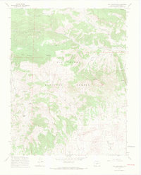
1967 Map of Twin Mountains
USGS Topo · Published 1969About this map
Rio Grande National Forest dominates this section of Saguache County, revealing a high-altitude landscape defined by timber, grazing, and early mineral exploration. The terrain is marked by distinctive geological formations such as the Natural Arch near Eagle Mountain and the prominent peaks of Blue Mountain and the Twin Mountains. The drainage patterns of La Garita Creek, Old Woman Creek, and Geronimo Creek suggest a long history of water management for livestock, supported by the presence of a dedicated Stock Driveway and numerous Pack Trails. Localized economic activity is evidenced by scattered Prospects in the southern reaches, where the mountains descend into English Valley. These features reflect a mid-century era of resource management where traditional ranching infrastructure and forest service surveying intersected.
Find a feature on this map
27 named features on this map. Tap any name to fly to it.
Don’t see what you’re looking for? This feature index may not catch every label — zoom into the map to look around manually.
Map Details
Editions of this 1967 Twin Mountains Map
4 editions found
Other maps of this area

1914 · Creede
USGS Topo · 1:125,000

1915 · Del Norte
USGS Topo · 1:125,000

1916 · Creede
USGS Topo · 1:125,000

1917 · Del Norte
USGS Topo · 1:125,000

1945 · Durango
USGS Topo · 1:250,000

1953 · Durango
USGS Topo · 1:250,000

1954 · Durango
USGS Topo · 1:250,000

1961 · Durango
USGS Topo · 1:250,000

1963 · Durango
USGS Topo · 1:250,000

1966 · Durango
USGS Topo · 1:250,000