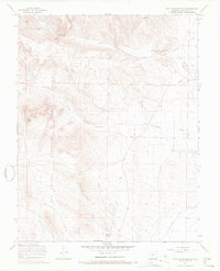
1967 Map of Twin Mountains SE
USGS Topo · Published 1969About this map
Rio Grande National Forest dominates the western half of this terrain, where the high desert meets the rising mountains of Saguache County. The map captures a high-altitude drainage system defined by Carnero Creek and La Garita Creek, which descend toward the San Luis Valley floor. Local social landmarks are concentrated near the northeastern corner, notably the St John Ch and an adjacent Cem, alongside Arroyo Mogotas. Evidence of early agricultural and industrial infrastructure is visible in the Rio Grande Canal and a long Pipeline, while distinctive formations like Eagle Rock, Elephant Rocks, and the aptly named Hellgate canyon pass serve as significant landmarks. The presence of several Prospect sites and a lonely Grave suggest the transient but persistent human activity common to this high-country landscape during the mid-20th century.
Find a feature on this map
18 named features on this map. Tap any name to fly to it.
Don’t see what you’re looking for? This feature index may not catch every label — zoom into the map to look around manually.
Map Details
Editions of this 1967 Twin Mountains SE Map
2 editions found
Other maps of this area

1915 · Del Norte
USGS Topo · 1:125,000

1917 · Del Norte
USGS Topo · 1:125,000

1945 · Durango
USGS Topo · 1:250,000

1953 · Durango
USGS Topo · 1:250,000

1954 · Durango
USGS Topo · 1:250,000

1961 · Durango
USGS Topo · 1:250,000

1963 · Durango
USGS Topo · 1:250,000

1964 · Sevenmile Plaza
USGS Topo · 1:24,000

1966 · Durango
USGS Topo · 1:250,000
1966 · Del Norte
USGS Topo · 1:24,000