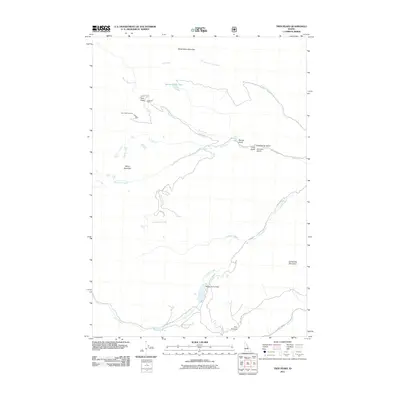
2011 Map of Twin Peaks
USGS Topo · Published 2011About this map
Twin Peaks Lookout Cabin stands as a primary high-altitude landmark in this 2011 survey of Custer County. The landscape is defined by the significant elevations of White Valley Mountain and White Mountain, which feed a complex network of drainages including Bear Creek and Challis Creek. This topography necessitated a specific transportation network, seen here in the winding paths of Twin Peaks Rd and Challis Creek Rd, which provide access to remote features like Spruce Gulch Lake. Downstream, the presence of Mosquito Flat Dam on Challis Creek indicates managed water resources in this high-country environment. The map also identifies several distinct gulches, such as Armison Gulch and Cold Spring Gulch, which have long served as local identifiers for navigation and resource extraction in the region's steep valleys.
Find a feature on this map
26 named features on this map. Tap any name to fly to it.
Don’t see what you’re looking for? This feature index may not catch every label — zoom into the map to look around manually.
Map Details
Editions of this 2011 Twin Peaks Map
This is the sole edition of this map. No revisions or reprints were ever made.
Other maps of this area
1919 · Custer
USGS Topo · 1:125,000
1922 · Custer
USGS Topo · 1:125,000
1929 · Bayhorse
USGS Topo · 1:125,000
1930 · Casto
USGS Topo · 1:125,000
1956 · Twin Peaks
USGS Topo · 1:62,500

1957 · Challis
USGS Topo · 1:250,000

1960 · Challis
USGS Topo · 1:250,000

1963 · Challis
USGS Topo · 1:250,000
1963 · Challis Creek Lakes
USGS Topo · 1:24,000
1963 · Bayhorse Lake
USGS Topo · 1:24,000