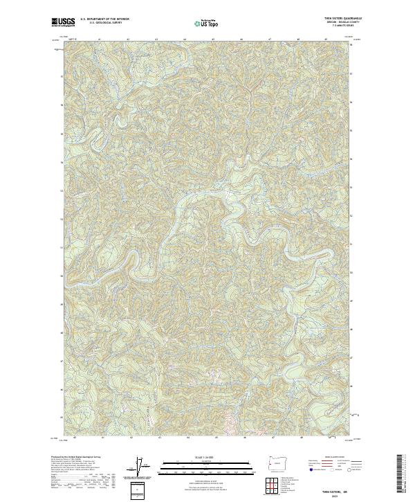
2023 Map of Twin Sisters
USGS Topo · Published 2023About this map
Smith River and its intricate network of tributaries define this part of Douglas County, where the landscape is carved by deep drainages and sharp ridgelines. The northern reaches are dominated by Roman Nose Rdg, while the southern portion is marked by the prominence of Scare Ridge. This 2023 survey illustrates a region shaped by modern forestry and water management, evidenced by the extensive Bureau of Land Management road network, including Smith River Rd and BLM Rd 1.0, which provide access to these remote timberlands.
Find a feature on this map
49 named features on this map. Tap any name to fly to it.
Don’t see what you’re looking for? This feature index may not catch every label — zoom into the map to look around manually.
Map Details
Editions of this 2023 Twin Sisters Map
This is the sole edition of this map. No revisions or reprints were ever made.
Other maps of this area

1919 · Earl
USGS Topo · 1:48,000

1942 · Roman Nose Mtn
USGS Topo · 1:62,500

1943 · Goodwin Peak
USGS Topo · 1:62,500

1945 · Roman Nose Mtn
USGS Topo · 1:62,500

1955 · Scottsburg
USGS Topo · 1:62,500

1955 · Elkton
USGS Topo · 1:62,500
1956 · Goodwin Peak
USGS Topo · 1:62,500

1958 · Roseburg
USGS Topo · 1:250,000

1959 · Roseburg
USGS Topo · 1:250,000

1979 · Cottage Grove
USGS Topo · 1:100,000