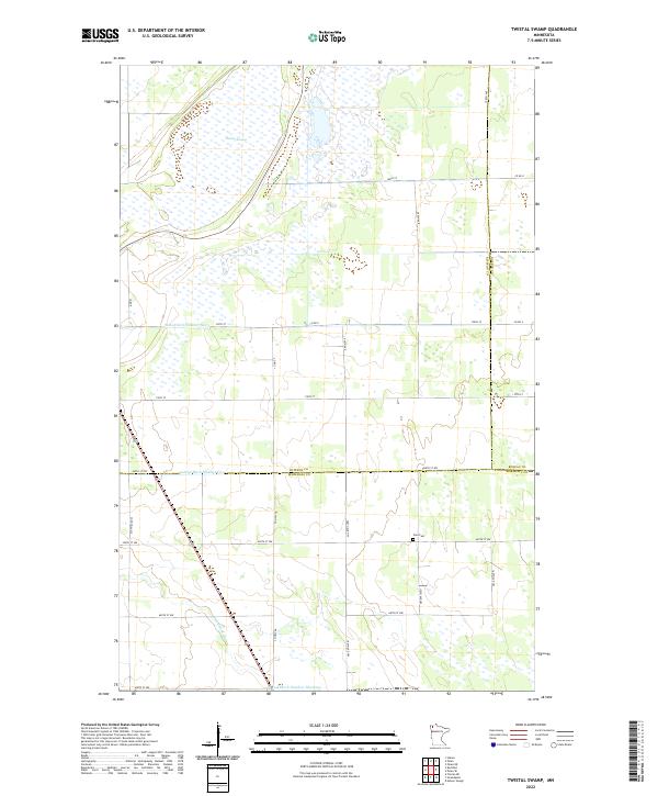
2022 Map of Twistal Swamp
USGS Topo · Published 2022About this map
Twistal Swamp dominates the landscape of this corner of far northwestern Minnesota, where the drainage patterns of the Red River Valley are managed by an intricate network of engineered waterways. Public land surveys from the 2020s reveal a region defined by agricultural utility and water management, with State Ditch Number Ninety and Lateral Ditch Number Five cutting straight paths across the terrain to channel runoff toward the meandering Tamarac River. In the southern portion of the map, Judicial Ditch Number Nineteen follows the Kittson and Marshall County line.
Find a feature on this map
32 named features on this map. Tap any name to fly to it.
Don’t see what you’re looking for? This feature index may not catch every label — zoom into the map to look around manually.
Map Details
Editions of this 2022 Twistal Swamp Map
This is the sole edition of this map. No revisions or reprints were ever made.
Other maps of this area

1919 · Pelan
USGS Topo · 1:62,500

1952 · Thief River Falls
USGS Topo · 1:250,000

1956 · Thief River Falls
USGS Topo · 1:250,000

1956 · Karlstad
USGS Topo · 1:62,500

1956 · Florian
USGS Topo · 1:62,500

1957 · Thief River Falls
USGS Topo · 1:250,000

1957 · Newfolden
USGS Topo · 1:62,500

1957 · Pelan
USGS Topo · 1:62,500

1967 · Thief River Falls
USGS Topo · 1:250,000
1982 · Pelan
USGS Topo · 1:24,000