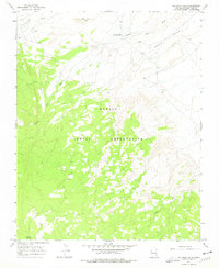
1966 Map of Two Grey Hills
USGS Topo · Published 1978About this map
Two Grey Hills and the surrounding high desert of the Navajo Indian Reservation are documented here through 1965 aerial photography and a 1966 field check. The landscape is defined by its drainages, notably Captain Tom Wash and Tuntsa Wash, which cut through a terrain of plateaus and ridges including the prominent Grey Mesa. Evidence of human presence and survival in this arid environment is indicated by a Cem and water sources like Mormon Spring and a simple Spring. The topography reveals a network of unimproved dirt roads and trails that traverse the hills, connecting isolated points across the open range. This survey, published by the Geological Survey in 1978, provides a precise look at the land's natural contours and sparse landmarks prior to modern development.
Find a feature on this map
9 named features on this map. Tap any name to fly to it.
Don’t see what you’re looking for? This feature index may not catch every label — zoom into the map to look around manually.
Map Details
Editions of this 1966 Two Grey Hills Map
2 editions found
Other maps of this area

1889 · Chaco
USGS Topo · 1:250,000

1892 · Chaco
USGS Topo · 1:250,000

1927 · Sulphur Spring
USGS Topo · 1:96,000

1928 · Kirtland
USGS Topo · 1:125,000

1932 · Kirtland
USGS Topo · 1:125,000

1953 · Sanostee
USGS Topo · 1:62,500

1954 · Shiprock
USGS Topo · 1:250,000

1958 · Shiprock
USGS Topo · 1:250,000

1959 · Shiprock
USGS Topo · 1:250,000
1966 · Sheep Springs
USGS Topo · 1:24,000
Featured Places
- Shiprock Agency
- Two Grey Hills, Shiprock Agency
- Kin Łizhin, Shiprock Agency
- San Juan County, NM
- United States