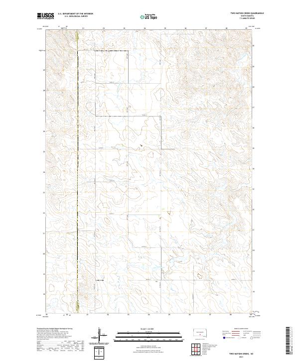
2021 Map of Two Nation Creek
USGS Topo · Published 2021About this map
The Mellette Co Tripp Co boundary line bisects this prairie landscape, where the drainage systems of the southern Great Plains have carved a network of subtle coulees and creek beds. The primary watercourse, Two Nation Cr, winds through the southern and eastern portions of the quadrangle, joined by the headwaters of Little Dog Cr and Cottonwood Cr further north. This area reflects the rigid organization of the Public Land Survey System, with a gridded network of section lines and gravel roads such as 297th Ave and 264th St defining the land use. The map illustrates a transitional terrain typical of the South Dakota interior, characterized by open rangeland and the expansive horizons of the Rosebud country before it meets the deeper river breaks to the north and east.
Find a feature on this map
22 named features on this map. Tap any name to fly to it.
Don’t see what you’re looking for? This feature index may not catch every label — zoom into the map to look around manually.
Map Details
Editions of this 2021 Two Nation Creek Map
This is the sole edition of this map. No revisions or reprints were ever made.
Other maps of this area

1951 · Badnation
USGS Topo · 1:24,000

1951 · Presho 4 NE
USGS Topo · 1:24,000

1951 · Presho 4 NW
USGS Topo · 1:24,000

1955 · Martin
USGS Topo · 1:250,000

1958 · Martin
USGS Topo · 1:250,000

1982 · Presho 4 SE
USGS Topo · 1:25,000

1982 · Two Nation Creek
USGS Topo · 1:25,000

1982 · Badnation SE
USGS Topo · 1:25,000

1982 · Witten
USGS Topo · 1:25,000
1982 · Carter
USGS Topo · 1:25,000